Maps Page on
Norway, Sweden, and Finland
Outline
- Physical Environment
- Topography of Norway
- Norway, Sweden, and
Finland
- Google Satellite Image
- Weather & Climate
- Climatic Variables in
Norway
- Climate Observations- Mean
Temperature Sweden
- Annual Mean
Temperature/Precipitation Finland
- Human Environment
- Life Expectancy at
Birth for Males and Females 2017
- Total Population Change
by Mean Component 2010-2018
- Change in Household
Disposable Income 2011-2017
- Road maps
- Norway
- Sweden
- Finland
- City Maps
- Oslo
- Stockholm
- Helsinki
- Urban Transportation Maps
- Oslo
- Stockholm
- Helsinki
- Tourist Maps
- Oslo
- Stockholm
- Helsinki
1 Physical
Environment
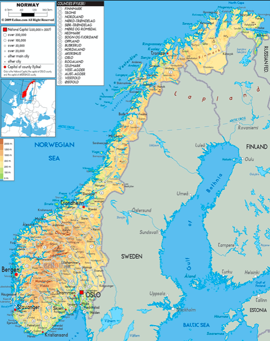
Here are 3 maps with descriptions of the physical environment of Norway, Sweden, and Finland
The first map shows the topography of each of the 3 countries. Finland is noticeably more flat than Norway and Sweden.
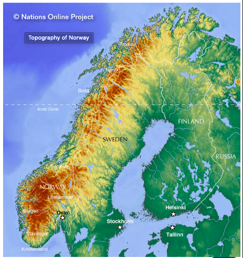
Source: https://www.nationsonline.org/oneworld/map/Norway-map.htm
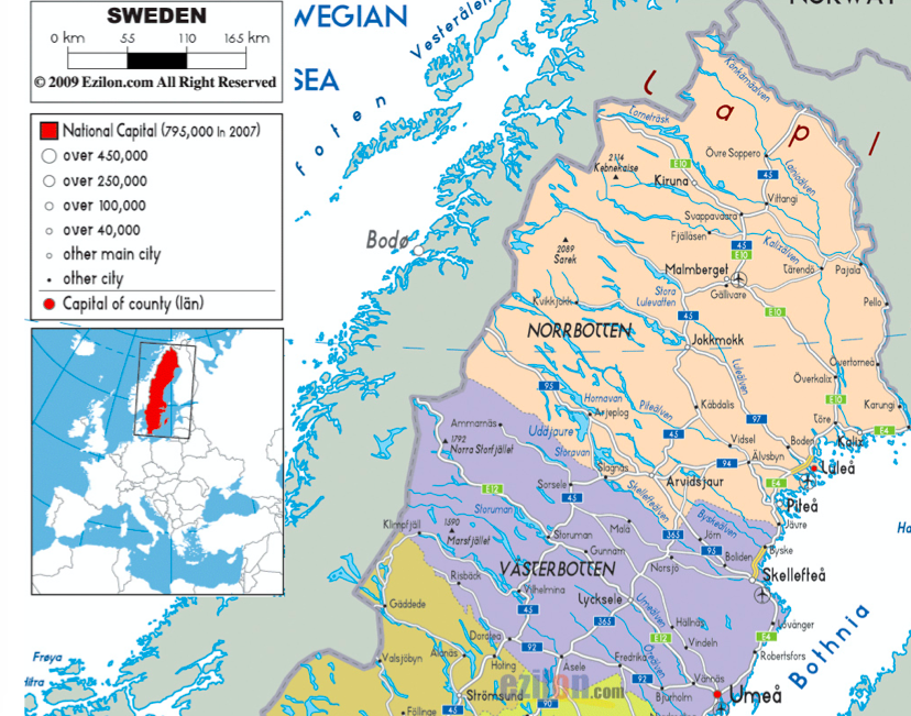
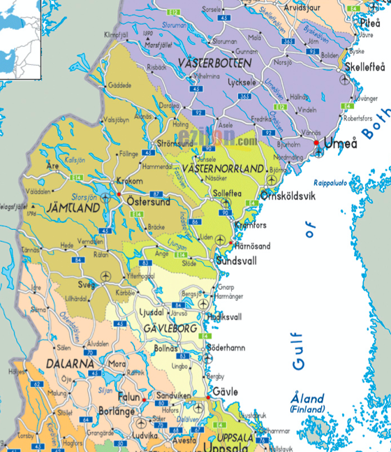
It wasn’t very easy to find a map with these 3 countries in particular, but here is a map that outlines the international boundaries, and some major and minor roads in Norway, Sweden, and Finland along with cities, the capitals, and rivers.
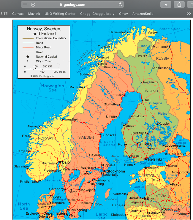
Source: https://geology.com/world/sweden-satellite-image.shtml
This map was fairly simple to find on Google Maps, but I had to zoon out to get each of the 3 countries in the picture. The map shows some minor details, including some lakes, the Baltic Sea and other bodies of water, and the Scandinavian Mountain range.
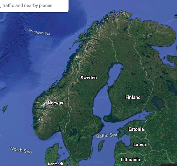
Source: https://www.google.com/maps/@64.0712456,14.2729785,2263855m/data=!3m1!1e3
2 Weather &
Climate
NORWAY
I found this map on a website
about a medical study, but I still think it is pretty useful. It shows the average
temperature during the summers in degrees Celsius, the precipitation in millimeters,
and the altitude of each region in meters. The coastal areas seem to get much
more precipitation than the areas in the mountains and higher elevations, and
not surprisingly, the areas in the northern part of the countries and with
higher elevation have lower average temperatures.
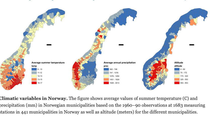
Source: https://bmcpublichealth.biomedcentral.com/articles/10.1186/1471-2458-13-530/figures/2
and https://bmcpublichealth.biomedcentral.com/articles/10.1186/1471-2458-13-530#Fig2
SWEDEN
The temperature map for Sweden is slightly different. The Norway map shows temperature data for the summer, and this map is annual mean temperature. It’s quite cold! I wanted to include the graph as well to show the temperature variation by month. That would probably be a major deciding factor for some people on what time of year to visit. I’d also like to note the abbreviations on the graph. The abbreviations are noting months: DJF = December to February, MAM = March to May, JJA = June to August, and SON = September to November. 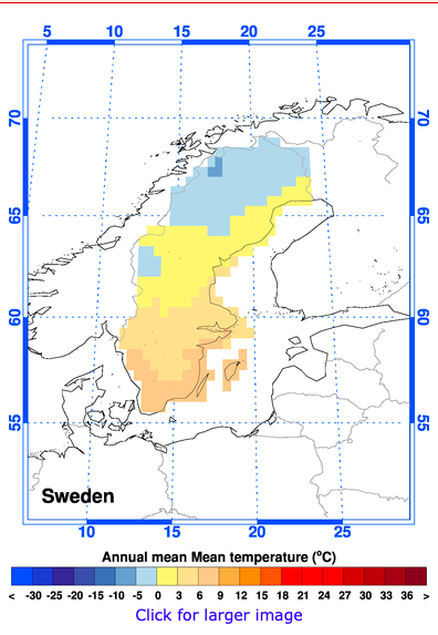
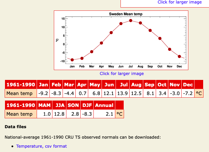
Source: https://crudata.uea.ac.uk/~timo/climgen/national/web/Sweden/obs_tmp.htm
FINLAND
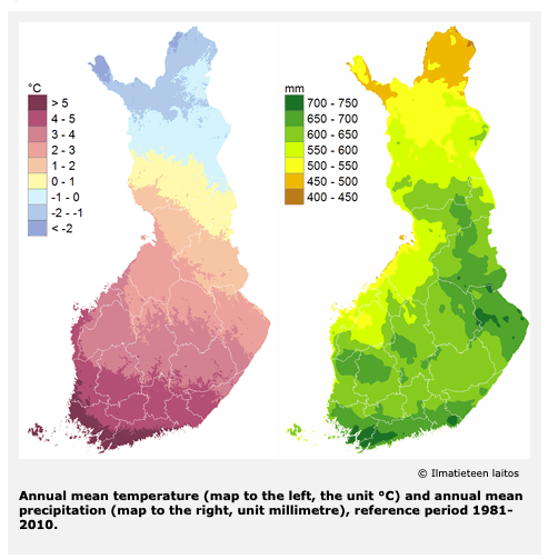
Source: https://ilmasto-opas.fi/en/ilmastonmuutos/suomen-muuttuva-ilmasto/-/artikkeli/1c8d317b-5e65-4146-acda-f7171a0304e1/nykyinen-ilmasto-30-vuoden-keskiarvot.html
3 Human Environment
I found a really great resource
for maps about these Nordic countries on https://nordregio.org.
This organization is an international research center established by the Nordic
Council of Ministers that researches topics in these countries including gender
issues, migration, urban/rural development and more.
After searching through some of
the maps on Nordregio, I came across this one. This map is fairly recent and
shows life expectancy for males and females in Norway, Sweden, Finland, and
includes Iceland and Greenland as well. The life expectancy is fairly high, and
after looking on another website- https://www.worldometers.info/demographics/life-expectancy/
- life expectancy in Norway, Sweden, and Finland is in the top 25 out of 191
countries.
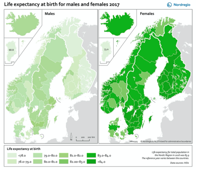
Source: https://nordregio.org/maps/life-expectancy-at-birth-for-males-and-females-2017/
I found this map to be interesting,
because it shows such a difference in populations changes between Norway,
Finland, and Sweden. Norway experienced an overall increase, and many areas in
both Sweden and Finland show a population decrease. Majority of population data
shows that there are higher areas of concentration closer to urban areas and
cities.
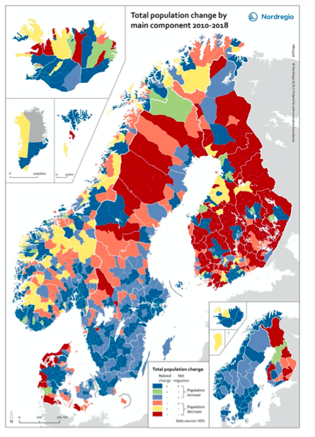
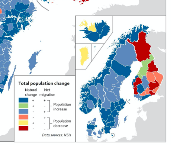
Source: https://nordregio.org/maps/total-population-change-by-main-component-2010-2018/
Norway, Finland, and Sweden have
all had changes in household income according to this next map, but Finland is
the country where the majority of municipalities have had a decrease in
household income. This means people have less income from things like
employment and social benefits, while Norway and Sweden have seen increases.
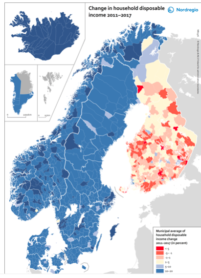
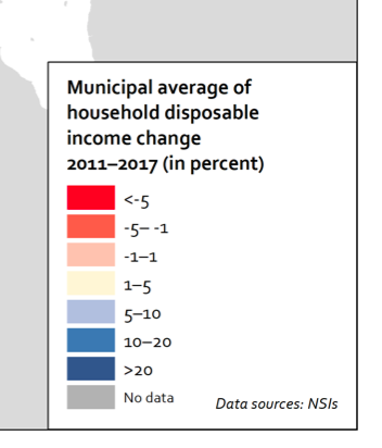
Source: https://nordregio.org/maps/change-in-household-disposable-income-2011-2017/
c
4 Road Maps
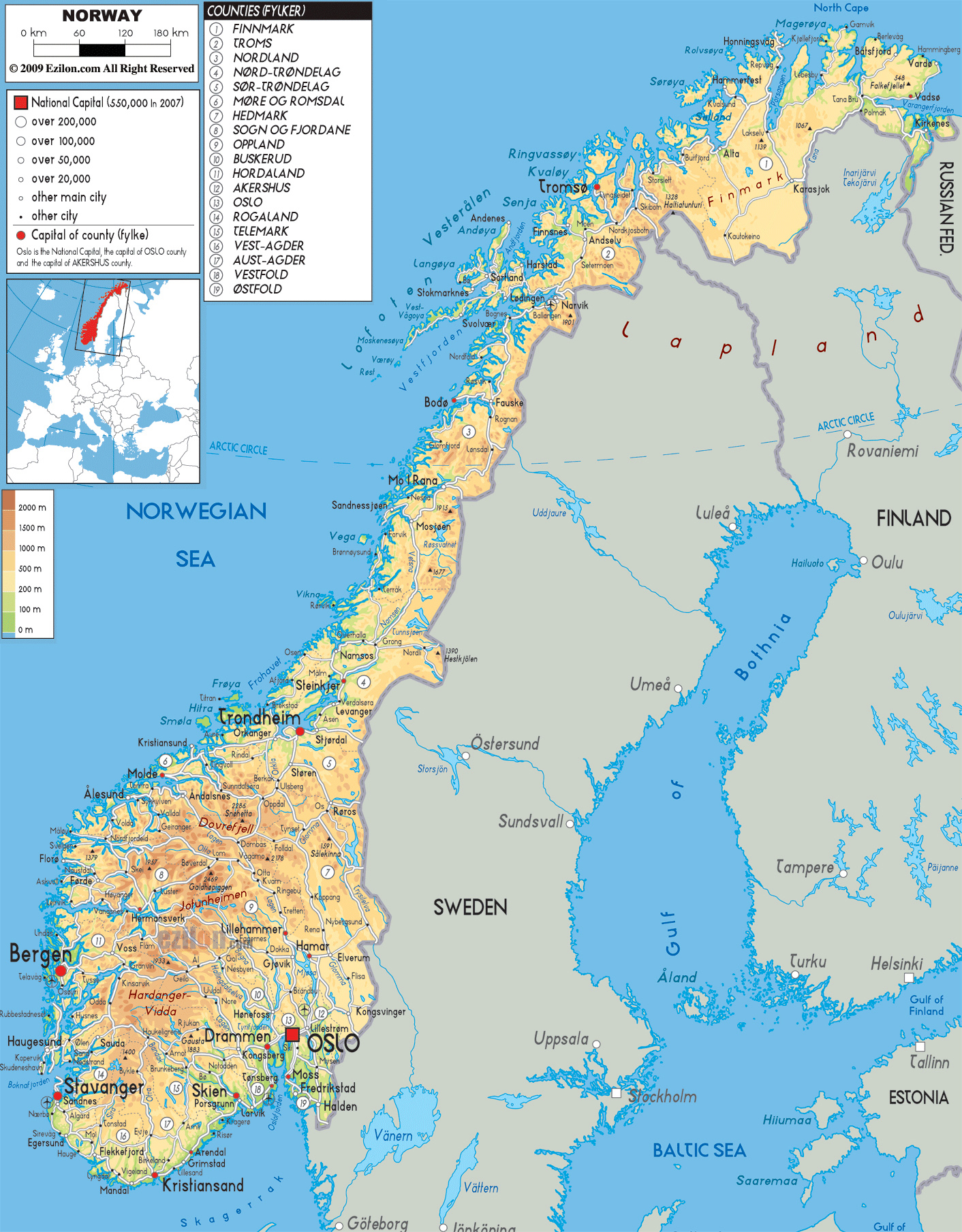
NORWAY
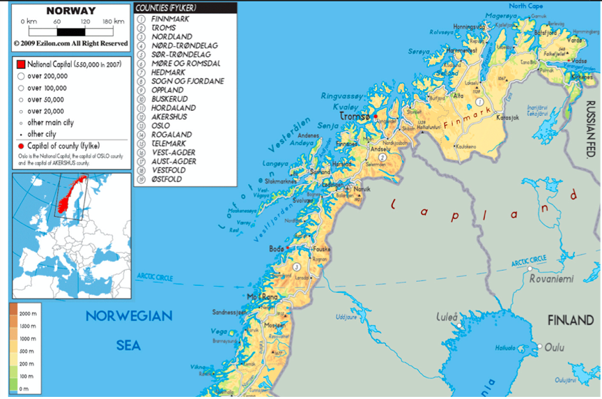
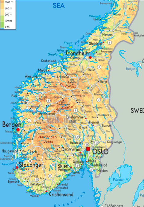
I like this map of Norway overall
because it includes really great information in the key- like elevation, major
cities and general population info, and county names.
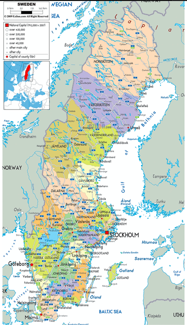
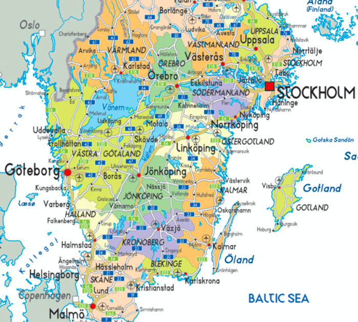
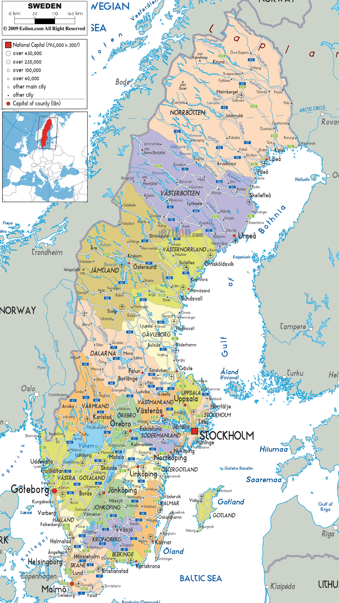
SWEDEN
This map is very detailed, outlining and color coding the different municipalities, major cities, airports, and roadways.
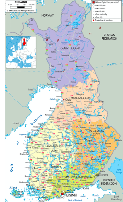
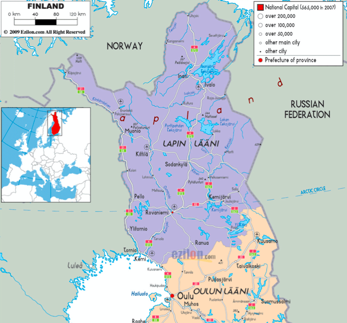
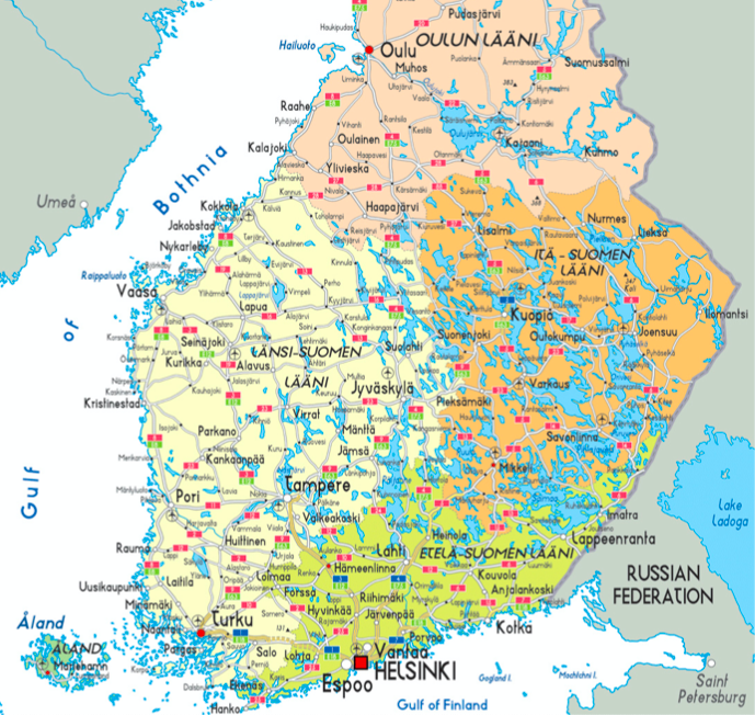
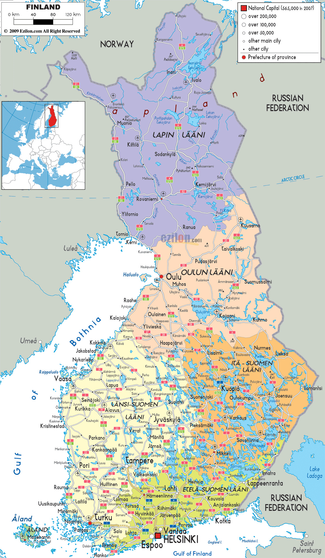
FINLAND
Finland is broken up into 6 zones, and was historically broken up into provinces. This map includes details about the capital, roads, cities, and airports.
5 City Maps
OSLO, NORWAY
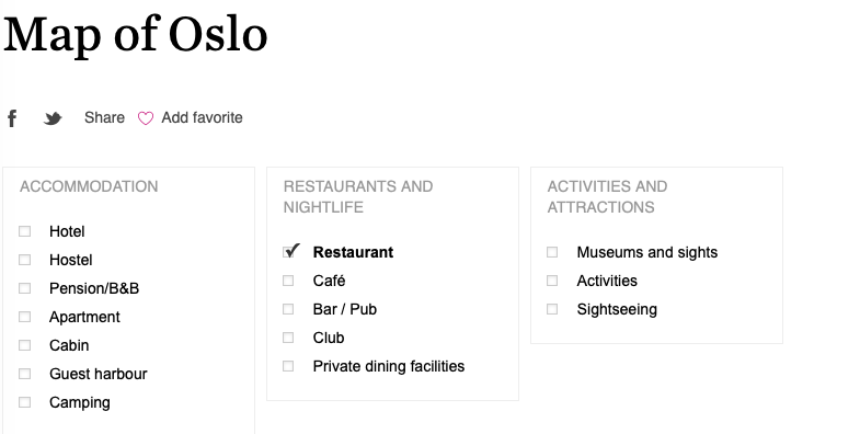
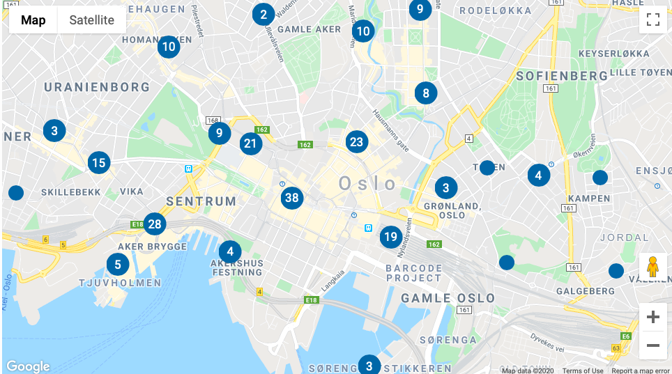
The website Visit Oslo has a
really great interactive city map of Oslo. You can click on things like hotel accommodations
or restaurants to see what’s in the area. I clicked on a few things to
show how they populate on the map.
https://www.visitoslo.com/en/map/
STOCKHOLM,
SWEDEN
About 7 years ago, when my
husband and I were dating, I bought him a Lonely Planet travel book- Europe
on a Shoestring. That book is still a useful resource, although it’s
a little old. This map I found on Lonely Planet’s website is similar to
the one from the book.
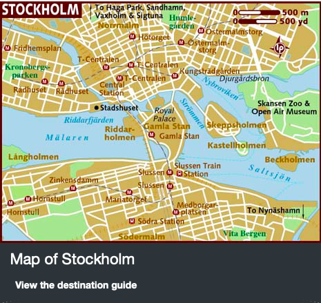
https://www.lonelyplanet.com/maps/europe/sweden/stockholm/
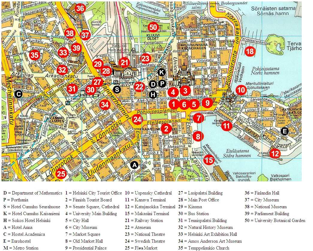
HELSINKI,
FINLAND
Orange Smile has come up on a
couple different searches, and it seems to be a pretty useful resource. This
map doubles as a tourist map.
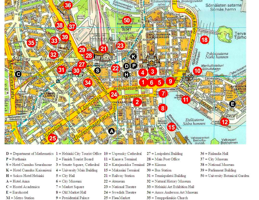
http://www.orangesmile.com/common/img_city_maps/helsinki-map-1.jpg
6 Urban
Transportation
OSLO, NORWAY
A little bit of googling led me
to https://ruter.no/en/journey/route-maps/
which has routes for the many forms of public transportation available in Oslo.
Here I’ve included a map for the bus system, but there are maps for the
subway, train, ferries, etc. This is a very good resource to have, this map
includes both Norwegian and English.
https://ruter.no/globalassets/rutetabeller/buss-oslo/linjekart/buss-oslo-linjekart-19082019.pdf
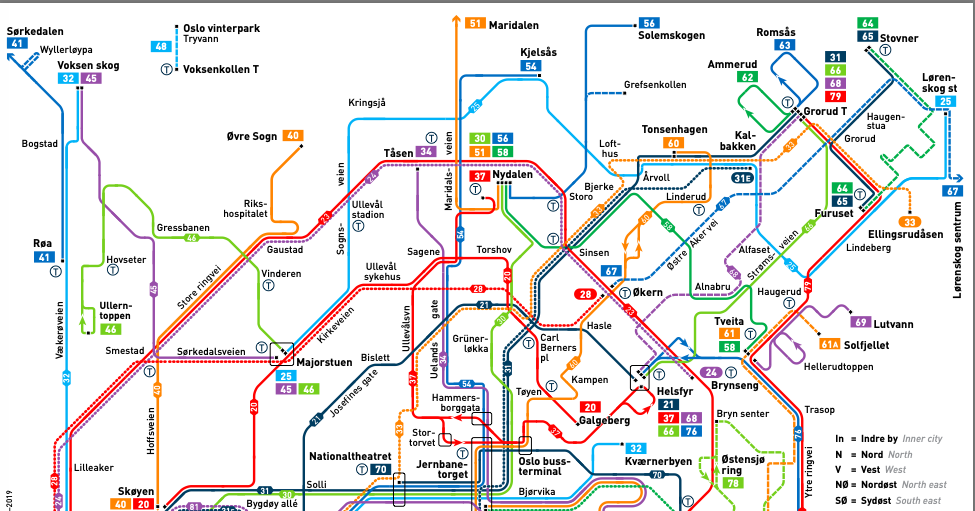
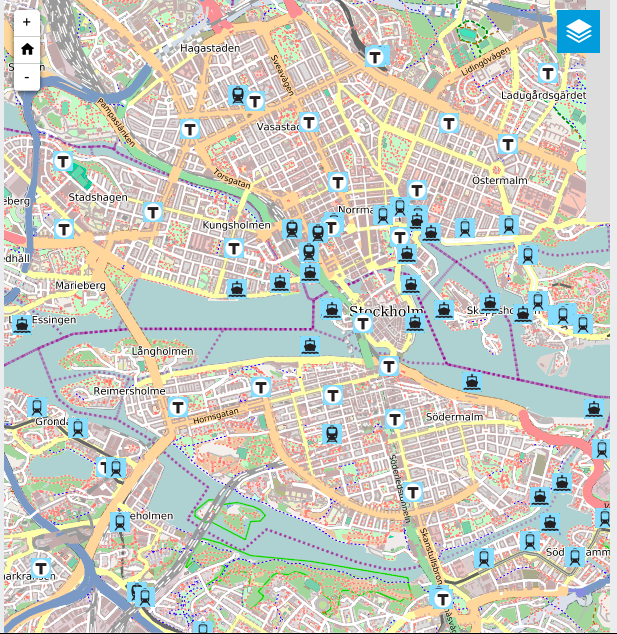
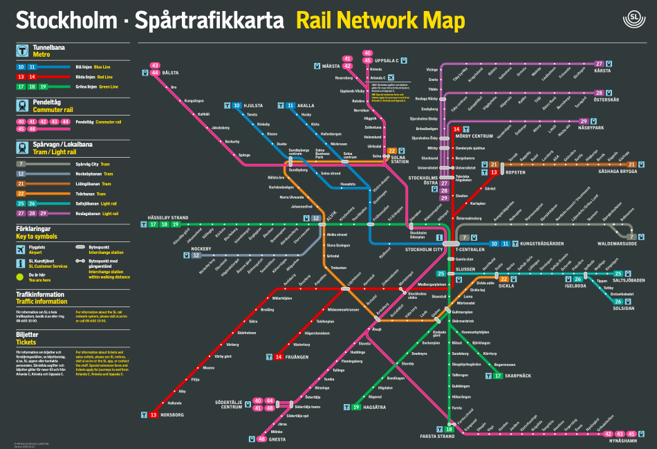
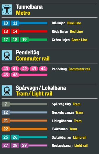
STOCKHOLM,
SWEDEN
Stockholm has plenty of public
transportation, and their website has mostly English settings so you can use
the interactive maps to get around. This PDF map is also useful to see all of
the means of transportation and which lines go where. The website has more information
about time and departures/arrivals.
https://sl.se/ficktid/karta/vinter/SL_Spårtrafik.pdf
https://sl.se/en/
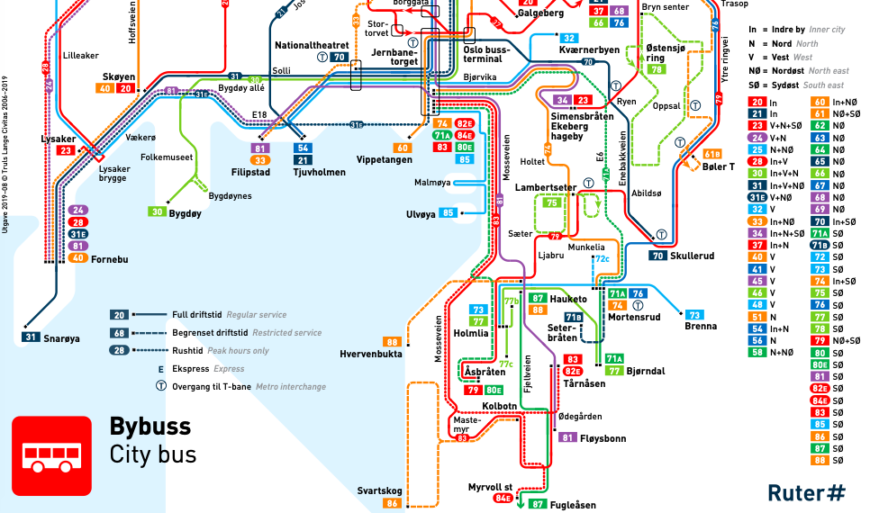
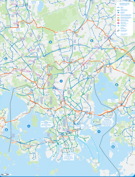
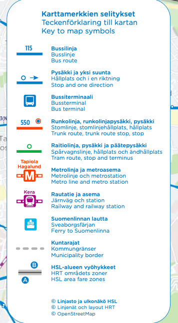
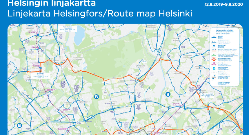
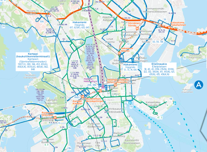
HELSINKI, FINLAND
Helsinki has a fairly extensive
network of commuter trains and trams. This particular map outlines the several
methods of transportation offered in and around the city.
https://www.hsl.fi/en/timetables-and-routes/routemaps
https://www.hsl.fi/sites/default/files/uploads/linjakartta_pysakki_hki-keskusta_810x1210mm_low.pdf
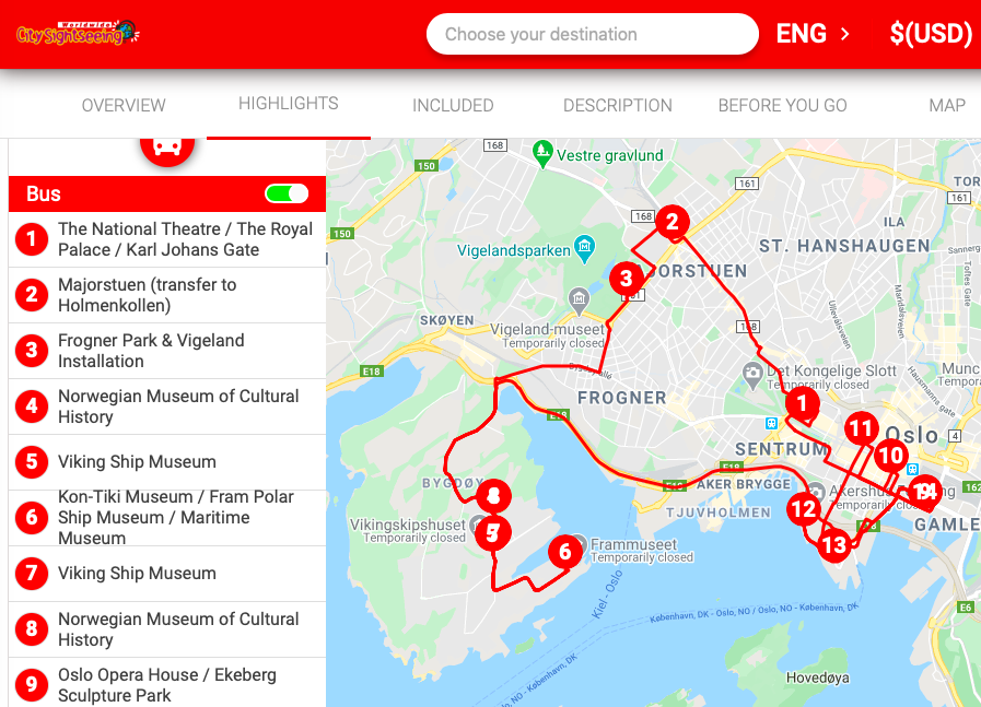
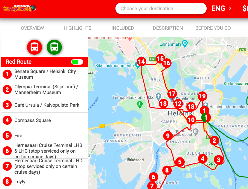
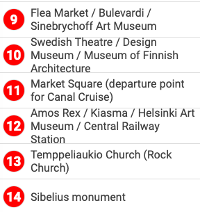
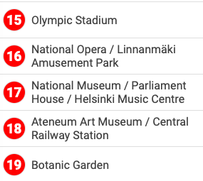
7 Tourist Sites
While some people find this a
little corny, I actually love finding the “big bus,” as my husband
and I call it, when we visit a new city. We typically budget for this type of excursion.
The CitySightseeing bus is one of several city tour busses you find in major
cities. I like being able to “hop on, hop off” of a bus at any
given time. It’s nice because you aren’t necessarily restricted on
time, like you may be on a different type of bus tour. You can spend as much or
as little time at a given destination in the city. Sometimes it’s just
nice to sit in the open-air top and ride around the city for the route in its
entirety before deciding which stop to exit. It’s also a good way to
gauge how busy a particular destination might be. If you see long lines, you
can stay on the bus and get off at the next stop to see something you may not
have chosen.
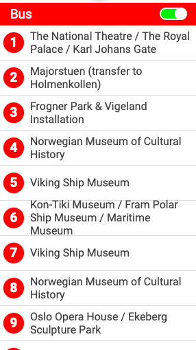
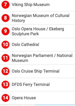
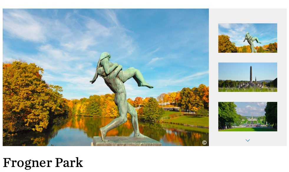
OSLO, NORWAY
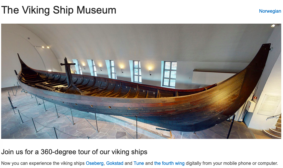
If I were to take the red route,
I would want to stop at the Viking Ship Museum, Frogner Park, and the Norwegian
Maritime Museum.
If I were to take the red route,
I would want to stop at the Viking Ship Museum, Frogner Park, and the Norwegian
Maritime Museum.
https://www.khm.uio.no/english/visit-us/viking-ship-museum/
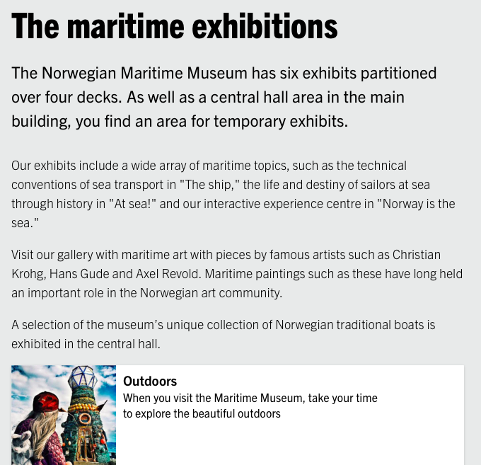
https://marmuseum.no/en/exhibitions
https://www.visitoslo.com/en/product/?TLp=229519
https://city-sightseeing.com/en/69/oslo/74/hop-on-hop-off-oslo
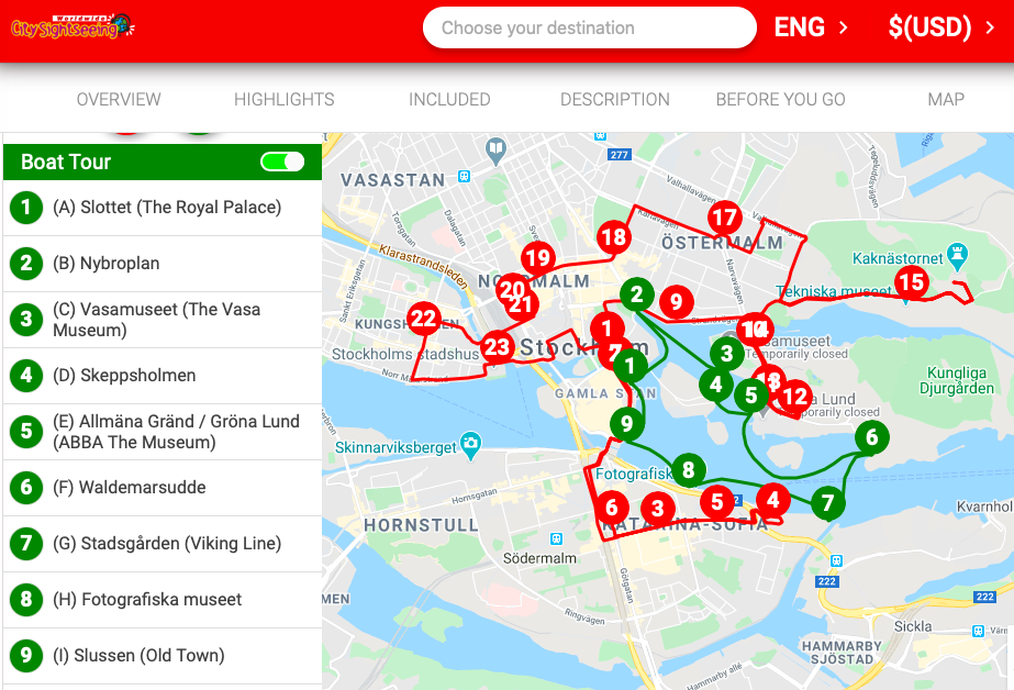
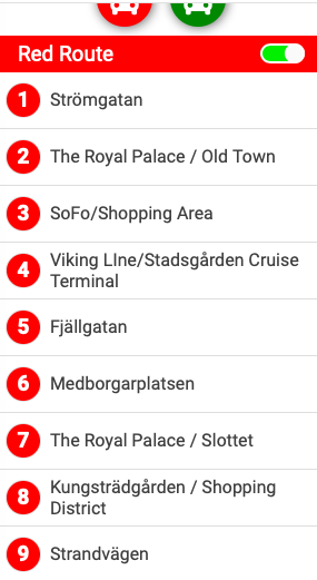
STOCKHOLM,
SWEDEN
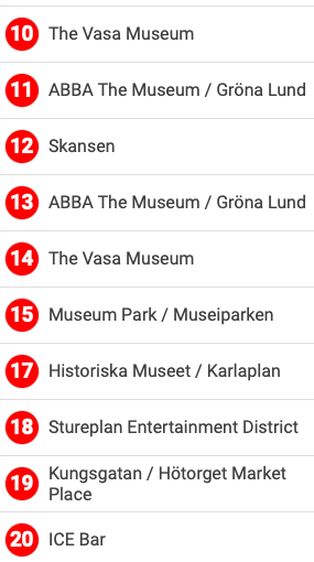
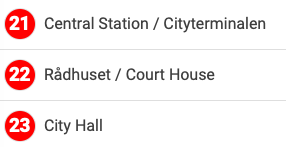
This CitySightseeing tour offers
a tour by bus and by boat. I’d probably buy a ticket that could be used
over the course of several days since there is a lot to see. One day I’d
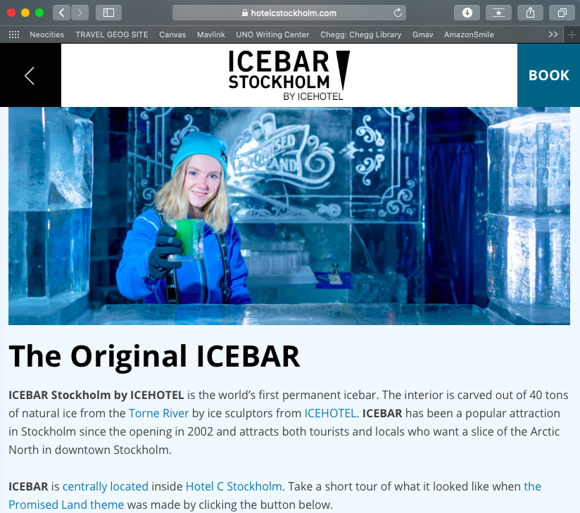
want to take the boat tour, then in another day I’d like to see the ABBA Museum
(I love ABBA!) and the ICE Bar. When my husband and I got married in Las Vegas
in 2014 we went to an ice bar in I believe the Monte Carlo, and that was a
really fun experience. I’d be interested to see what this one is like!

https://city-sightseeing.com/en/109/stockholm/243/hop-on-hop-off-stockholm
https://abbathemuseum.com/en/?gclid=EAIaIQobChMInY3n3Yzu6AIVRl8NCh35qAVJEAAYASAAEgKQOPD_BwE
https://hotelcstockholm.com/icebar-stockholm-by-icehotel/
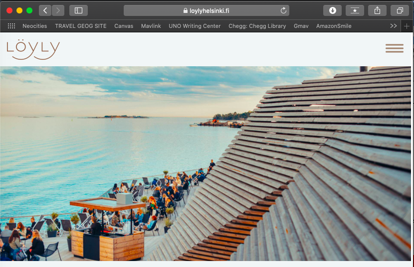
HELSINKI,
FINLAND
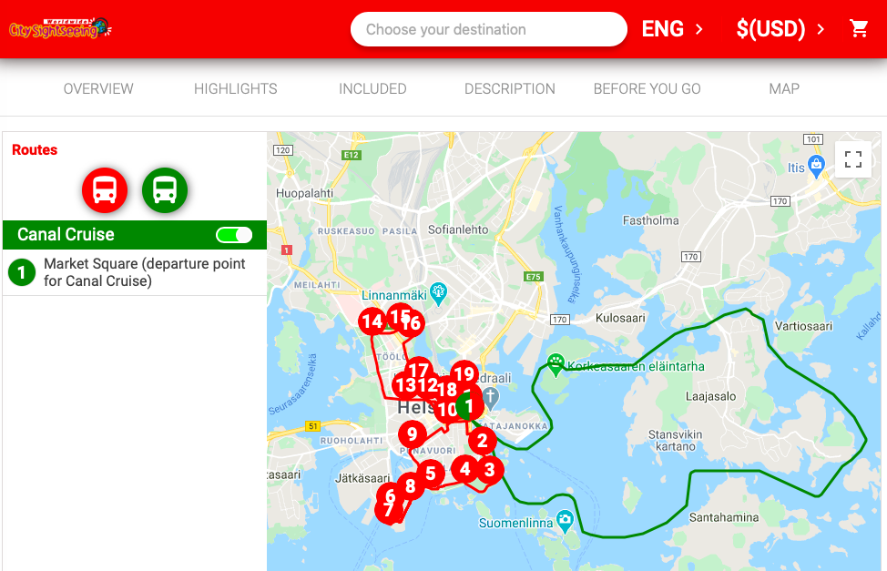
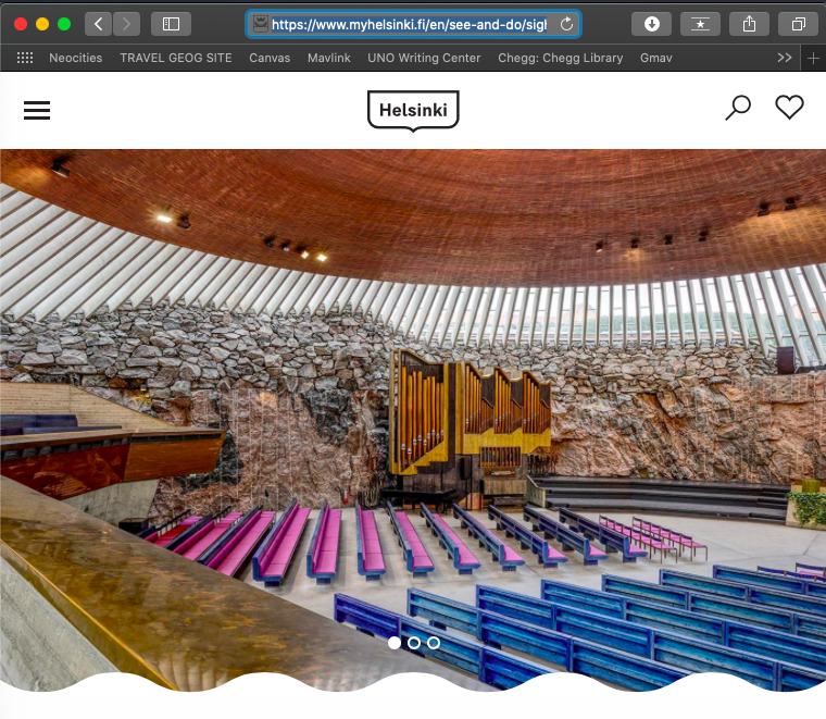
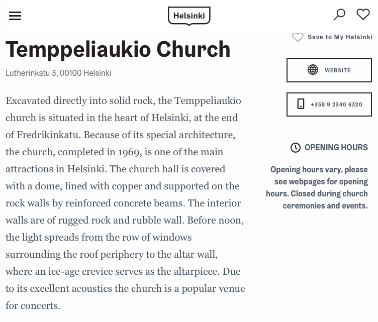
Like Stockholm, I would purchase a multi-day ticket. A canal cruise would be so fun, I enjoyed a canal cruise when I visited England a few years ago. I’d really like to visit Löyly for the shopping and restaurants, and saunas. I would also like to see the Rock Church.
https://city-sightseeing.com/en/40/helsinki/40/hop-on-hop-off-helsinki
https://www.myhelsinki.fi/en/see-and-do/sights/temppeliaukio-church
Submitted
by Victoria Follin